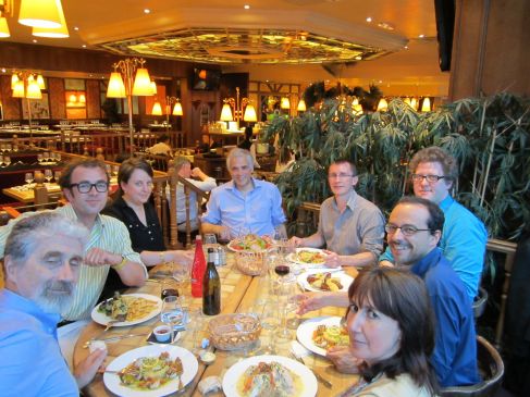
The Rennes meeting of the news networks in early modern Europe Leverhulme-funded project took place on 9-11 May at the Université Rennes 2. At this stage the project — which is exploring methodologies for writing a pan-European history of news communication — is by invitation only. At this event we heard papers from Mark Greengrass (Sheffield), Stéphane Haffemayer (Caen), Johann Petitjean (Ecole Française de Rome), Marion Brétéché (Paris-Sorbonne), and Sara Barker (Exeter), as well as presentations from the core participants of the network.
Much as I’d like to summarise all the themes that arose in discussion — proposed projects, the quite strong disagreements about approaches and the relations between manuscripts and printed items — there’s too much to digest here. Instead I want to pick on a practical issue that we deliberated on from several angles: how we should map the networks of communication along which news flowed across Europe.
One way we’re approaching our project is by drawing up case studies — of particular news forms, modes of communication, events — and seeing how they interconnect. I’ve recently written a paper about the response to Milton’s Defensio (1650) in which I chart dialogues about Milton’s book across Europe over time, using colour-coded arrows and circles on a roughly contemporaneous map. If we were to do this using a shared map, then the case studies that we collectively compiled could be superimposed one on another, and the most connected centres or nodes, and the various permutations of the relationships between these nodes would (might) become evident. At least in an ideal world. But also in a nightmare world, in which all relationships are reduced to cartography.
Of course one problem is that maps change over time. Political boundaries shift, dominion disappears. That has a simple practical solution: we need to use a map that represents mountains, rivers, coastlines, cities, and not political boundaries. But even this might mislead, by leading to too mechanical an understanding of the movement of news and manuscripts and books. There is too much that resists the paradigm of a map. The movement of news needs to be understood in a more culturally-inflected manner, by which I mean that a range of factors — from prevailing understandings of time and space and movement down to the economics of production and consumption — shape not only the movement of news but what it means in society. Distribution not only enables interpretation but also influences it.
Mark Greengrass offered a useful phrase, to describe what is lost by seeing the emergence of periodical news too mechanically: “l’imaginaire des nouvelles”. What else constitutes this “l’imaginaire des nouvelles”? Suggestions please, and we’ll follow them up.
Nonetheless we still need to know how books and papers moved. So at the next workshop, to be held somewhere in the former Hapsburg Empire in late summer, we will consider the various distribution networks that extended across Europe. Using our local expertise — in Britain, France, Spain, the Netherlands, Portugal and Italy — we will trace the main means by which books and papers were transported, and at what speeds, by carrier, postal services, merchant routes. Anything that seems relevant, or reconstructable; I suspect that what works in Britain won’t in Italy; and that Spain’s routes are more esoteric and personal than the Dutch Republic’s. Then, on a shared map, we will find the points at which these networks intersected. We may even find the boundaries of some of our networks. And even if we find ourselves discussing fundamentally different incompatible things, we will have learned something about the chaos inherent in Europe, or the differing intellectual and scholarly frameworks within which our colleagues are working.

If you have any thoughts about the practicalities or illusions of this approach we would be interested in hearing from you.


One issue, for instance would be to find ways of measuring the volume of traffic through the network, or particular networks; which is crucial to how the networks operate, but not easy to represent schematically. Or whether the nature of the material (printed, manuscript) in circulation affects the shape of the network, and how to represent that. Suggestions welcome!
I suppose this can be categorized under economics of production: perhaps a factor to consider would be the movements of the journeymen printers and how they affect the material printed from worksite to worksite. Over time, does one printer become a specialist in particular kinds of books or pamphlets?
Also, it might be interesting to think in terms of information that is commonly grouped or moved together – I remember reading that revolutionary tracts in France during the Old Regime were grouped and shipped with lewd, pornographic printed material.
Hi Joad, really interesting post. Have you seen Orbis? http://orbis.stanford.edu/ It’s an interactive model or ‘dynamic distance cartogram’ of the Roman World based on travel time and most importantly, cost. It’s pretty amazing. As you mention, political boundaries shift but I would imagine bar new technologies and major infrastructure changes the cost of travel to particular places stays a lot more consistent.
A similar system for the Early Modern World wouldn’t help in tracing the information networks themselves, but perhaps would a more useful way of conceptualising the space of Europe than doing so purely geographically or geopolitically. Or maybe just another unnecessary complication!
Pingback: carnivalesque 86 » Wynken de Worde
We could approach the history of news and its networks more in connection with the development of postal services in early modern Europe. Then ‘our map’ would be one of postal routes connecting the whole of Europe. An interesting article is W. Behringer, ‘Communications Revolutions: A Historiographical Concept’, 24(3) German History, 2006, 334-374.